Boone County, Arkansas

- Formed: April 9, 1869
- County Population 1870: 7,032
- Slave Population 1860: NA
- Civil War Engagements
-Skirmish at Klepper’s Mill, March 31, 1863
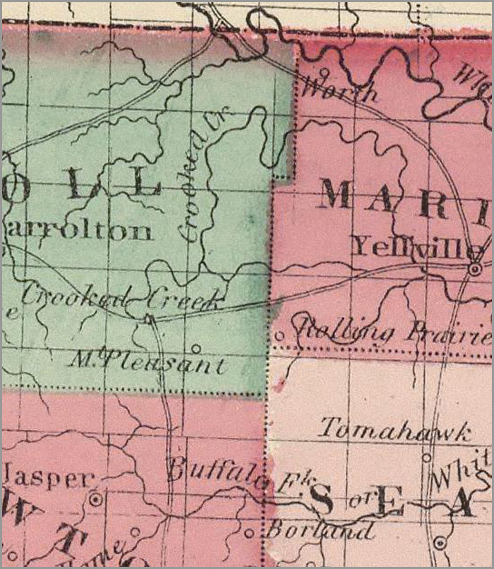
Image courtesy of the David Rumsey Historical Map Collection
Boone County, Arkansas, is located on the Missouri-Arkansas border in the Northwestern portion of the state. It has abundant timber resources, including maple, pine, cherry, and elm. Caves in the area contain natural saltpeter, an ingredient in gunpowder manufacture. The abundant prairies in the area—Baker’s Prairie, Huzzah Prairie, Rolling Prairie, Mitchell’s Prairie, Sugarloaf Prairie, and Marshall’s Prairie—provide grazing grasses for livestock. The soil is suitable for growing corn, beans, squash, and sweet potatoes.
Boone County was traditionally Osage territory. In the early 1800s, Cherokees were moved out of Tennessee into Arkansas, Kansas, and Missouri, and the Boone County area was in Cherokee control until the early 1820s. White settlement began as early as 1811, when Joseph Burkett moved near modern day Hanson. The Boone County area was included in Carroll County, which was established November 1, 1833 with a county seat at Carrollton. After the county was established, settlers began to arrive more frequently. Two veterans of the War of 1812, Colonel Beal Gaither and John Woody, resided in the Boone County area. Samuel W. Peel, later a congressman, settled here in 1841. A veteran of the Revolutionary War, Jordan Milam, also made his home in the region. Most of the new residents came from Kentucky, Virginia, South Carolina, Georgia, North Carolina, Mississippi, and Alabama. By the 1850s, a commercial lead mine and gunpowder manufactory opened in the area. Dubuque and Sugarloaf townships were soon established.
In the late 1850s, several residents from Boone (then Carroll) County and other counties in Northwestern Arkansas immigrated to Utah. When they arrived, they passed through a large Mormon population, who mistakenly thought that the Arkansas immigrants were there to persecute them. The Mormons asked the Native Americans in the area to help them attack the Arkansas immigrants. In what became known as the Mountain Meadows Massacre, the Mormons and Native Americans killed almost the entire group on September 11, 1857.
Because most settlers came from southern slave states, when the Civil War began Boone (then Carroll) County residents sided with the Confederacy. They felt stronger ties to their state government than to their federal government, and the county voted to secede. Brigadier General James H. McBride formed the first Confederate regiments in June of 1861. The 14th Arkansas Infantry formed at Yellville, and the 27th Arkansas Infantry formed at Bellefonte. Other regiments included the 1st Arkansas Regiment, 2nd Regiment, Arkansas Cherokee Cavalry, and the 2nd, 3rd, 4th, 8th, 10th, 13th, 14th, 16th, 19th, and 27th Arkansas Infantries. Confederate troops in the area also included General Sterling Prices Missouri troops and Sam Reed’s Mounted Infantry. Many Union supporters in the region left for Missouri and joined the 1st Arkansas Cavalry to fight for the Union. Bushwhackers were a constant threat to settlers and attacked citizens regardless of their political alignment.
Confederate troops in the area occupied the gunpowder manufactory to gain easy access to ammunition. However, on November 30, 1862, Union troops destroyed the manufactory. On March 31, 1863, a small skirmish took place at Klepper’s Mill, between Confederate troops under John Marmaduke and Union troops under Francis J. Herron. The Confederates wanted access to Springfield through Carrollton, the Union army wanted to protect access to Springfield. During November and December, 1863, both armies were involved in skirmishes with bushwhackers, and in January 1864, a small skirmish took place on Crooked Creek.
The region was completely devastated by Civil War. Shortly after the war’s end, Boone County was officially established on April 9, 1869, taking half of the land and half of the population in Carroll County. Boone County was probably named after Daniel Boone. The county seat was almost located at Bellefonte, but the political sentiment was still too divided in this area from the Civil War. The county seat was moved to neutral territory and Harrison beat out nearby Bellefonte by a mere 18 votes in an election to settle the issue. The county court established Bear Creek, Carrollton, Crooked Creek, Harrison, Jackson, Jefferson, Long Creak, Prairie, Sugarloaf, and Washington townships. A lead mining town was established shortly afterward and named Lead Hill.
 Browse all collections in Boone County
- Consulted:
- History of Boone County, Arkansas. Boone County Historical and Railroad Society, Inc. (Paducah, KY: Turner Publishing Company, 1998).


